Coastal managers commonly predict and plan for sea-level-related beach movement using the Bruun Rule, a linear formula that predicts beach recession based on the shape and slope of the upper shoreline. Bruun Rule calculations predict 1 m (3 ft) of global mean sea-level rise by 2100, causing beachfronts around the world to recede inland as much as 100 m (328 ft). Such an extreme loss would destroy nearly half of the world’s existing beaches.
But new international research published in the journal Nature Communications Earth & Environment, offers hope.
An international team of scientists from Australia, England, and Mexico contends that extreme storms, which affect the shape of virtually every coastline, offset sea-level rise effects projected under the Bruun Rule. Their work describes how amplified winds and waves generated during extreme storms tend to send huge quantities of sand from deep ocean water toward the beachfront. The team’s long-term analysis finds that these sudden influxes of sand are enduring, often staying along the shore for years or decades. Potentially, the researchers write, the amount of sand conveyed inward during extreme storms could even offset the projected effects of sea-level rise and make beaches more resilient to climate change.
“The Bruun Rule has been criticized for its simplicity, as it doesn’t take into account the many complex factors about how individual beaches respond to sea-level rise,” said Gerd Masselink, University of Plymouth (England) coastal geomorphologist and study co-author, in a release. “This includes the presence of sand stored in deeper water immediately off the coast – and its potential to be mobilized during extreme weather events.”
LOOKING ABOVE AND BELOW THE SURFACE
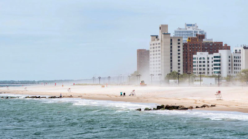
The research team focused on three beaches: Narrabeen Beach in Sydney, Australia; Perranporth Beach in Cornwall, England; and La Misión Beach in Baja California, Mexico. At each of these beaches, coastal managers operate comprehensive monthly survey campaigns that reveal long-term changes in the shoreline using a range of aircraft, drones, boats, and lidar systems. Study authors used this data to examine the effects of major storms, focusing on survey results before, immediately after, and one year after a severe event. The analysis not only sought to identify above-ground patterns, but also changes in the amount of sediment beneath the surface of deep, offshore waters.
“We know that extreme storms cause major coastal erosion and damage to beachfront properties,” said lead author Mitchell Harley, an environmental engineering professor at the University of New South Wales (Sydney, Australia), in a release. “For the first time, we looked not just above water, where the impacts of extreme storms are easy to see, but also deep down below the water as well.”
At each of the study sites, the researchers identified periods of uniquely extreme storms – such as a system that caused a temporary loss of about 50 m (164 ft) of shoreline at Narrabeen Beach in 2016 – followed by a prolonged period without an extreme storm in order to study long-term trends of storm-related sediment transport.
SAND AS A SILVER LINING
Survey data before and after the 2016 Narrabeen Beach storm demonstrated that although the beachfront had largely disappeared during the event, its sand was not lost. On the contrary, the researchers report that the storm brought as much as 400,000 m3 (14.1 million ft3) of additional sand from deeper waters into the coastal ecosystem, which was centralized underwater during the storm and gradually dispersed across the beachfront as coastal floodwaters receded. Similar patterns were observed at Perranporth Beach, where a spate of winter storms in 2016 was found to add approximately 420,000 m3 (14.8 million ft3) of sand, and at the comparatively smaller La Misión Beach, where severe storms in 2019 had added approximately 130,000 m3 (4.5 million ft3) of sand.
“What we found was that hundreds of thousands of cubic meters of sand were entering these beach systems during these events – that’s similar to the scale of what engineers use to nourish a beach artificially,” Harley said. “It’s a new way of looking at extreme storms.”
Although these results suggest that how beaches might respond to sea-level rise is not as simple as the Bruun Rule predicts, study authors caution against the conclusion that extreme storms by themselves will protect beachfronts from sea-level rise. While all three studied beaches displayed similar patterns, the researchers write that the complex array of factors affecting coastal sediment transport mean each beach’s response to climate change is unique.
“We’re only scraping the surface here. We need to repeat these types of monitoring measurements for more storms and different types of coastal settings under various conditions,” Harley said. “Only then will we be able to get a clearer understanding of how much sand is stored off the coast that could potentially help buffer the impacts of sea-level rise – and a clear picture of what our beaches could look like in the year 2100 and beyond.”
Read the full, open access study, titled “Single extreme storm sequence can offset decades of shoreline retreat projected to result from sea-level rise,” in Nature Communications Earth
& Environment.
ABOUT THE AUTHOR
Justin Jacques is editor of Stormwater Report and a staff member of the Water Environment Federation (WEF). In addition to writing for WEF’s online publications, he also contributes to Water Environment & Technology magazine. Contact him at jjacques@wef.org.